SURF COACHING
DONE WITH LOVE
It all begins with an idea. A feeling. A wish.
Then we get caught by the desire for more. We fall in love with the way we flow, feel and glide. Getting better at surfing means having fun in every type of wave anywhere in the world.

AS FEATURED ON:


MORE FUN AND CONFIDENCE IN YOUR SURFING THROUGH:
PERSONAL COACHING
It can be private or group and online or live of the beach. Whatever it is, we will find a way to improve your fun and confidence in the water together. Through improving your technique, line up tactics, boardchoice, mindset and/or physical fitness. It’s all part of the same game, becoming a better and more versatile surfer.
SURFCOACHING TRIPS
Daily surfcoaching in the best waves with a group of likeminded people is a sure way for an amazing time and loads of progression. From level 2 you’re welcome to join the trip and as many guests have already said during the trips: “This is the best investment I’ve ever done for my surfing.”
ONLINE COACHING - WHENEVER AND WHEREVER YOU WANT
The knowledge collected over 20 years of surfing and 10 years of coaching are all available 24/7 via Surf Academy Pro. “We are drowning in information, while starving for wisdom.” This is an online platform where we combine high quality knowledge with online surfcoaching for all your questions, photo/video analysis and a motivating community to share your progress with.

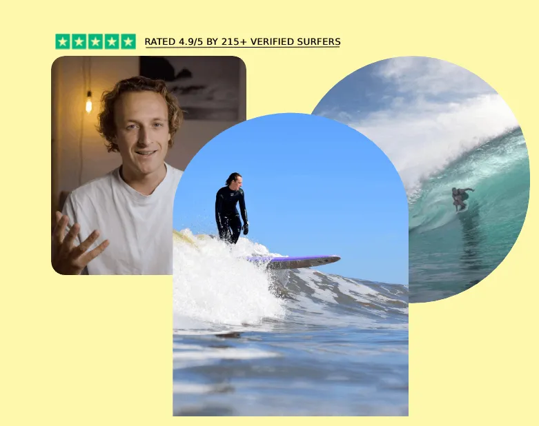
RATED 4.9/5 BY 215+ VERIFIED GUESTS
SEEING AND FEELING PROGRESSION
Pepijn sees perfectly what issues are preventing you from improving your surfing skills, and gives hands-on advice on them. Pepijn creates a safe evironement where you are encouraged to make as much mistakes as you can.
The group can be divers, but all participants are equally happy for you when you finally make that turn, get that stance, of ride that wave.
Not only does he give you verbal tips, but he makes you see and feel why what you are doing is not working, and what you need to do to make it work.
- Menno van Duijn - October 2024
NOT ONLY EDUCATIONAL, ALSO INCREDIBLY FUN
I had the pleasure of doing a week of advanced surf coaching in Portugal and all I can say is: it was absolutely fantastic!
The surf coach is simply great - not only a real pro on the board, but also incredibly competent and motivating as a coach.
Pepijn manages to find a pleasant balance between professionalism and a relaxed atmosphere, which makes the coaching really unique.
Not only did I take my surfing to a new level, but I also had a great time. I can only warmly recommend it!
- Lena - October 2024
PERSONALLY TAILORED SURFCOACHING
Pepijn made sure to tailor his expertise and tips to each of us. I feel like a learnt a lot this week and that I have goals to focus on to improve my surfing.
Pepijn made sure to tailor his expertise and tips to each of us. I feel like a learnt a lot this week and that I have goals to focus on to improve my surfing.
It was a chill week, yet packed with highly valuable insights and tips.It was a chill week, yet packed with highly valuable insights and tips.
I highly recommend Pepijn as surf coach.
- Rémi Cottes - October 2024
BEST COACHING I'VE EVER HAD
Just straight up best coaching I ever had. Pepijn explains it super well and really makes you think about what you are actually doing in the water.
Great tips and guidance with help of the video analysis.
On top of it all, he’s just an overall genuine awesome dude!
- Wouter - September 2024
NOT YOUR AVERAGE SURFTRIP
What is special about these tips is that I understood the logic behind them and so got some tools from Pepijn I can help myself with in the future as well.
He also created an accepting and relaxed environment in which it felt safe to make mistakes and then work on them.
This was really important for fast and effective learning.He’s been a great host too, adjusting the weekly programme to the group’s needs and keeping it really fun.Can’t wait for the next trip!
- Luca - September 2024
FINALLY A FIRM GRIP ON MY PROGRESSION
Pepijn is super easy to get along with, driven to understand you, and passionate about helping you move forward, in whatever way.
This coaching is especially recommended if you want to analyze your surfing, so you know what’s going well and what steps you need to take next.
It’s not so much about catching the most or best waves (which, of course, is also a lot of fun), but more about getting a grip on your progress by setting appropriate goals and working towards them.
Comfortably out of your comfort zone, it is safe to be vulnerable. The atmosphere in the group is friendly, open and positive. In short, a fantastic week
- Nienke - September 2024
I’D LOVE TO ANSWER ANY OF YOUR QUESTIONS:
EMAIL ME ON [email protected]
DM ME ON INSTAGRAM @PEPIJNTIGGES
WHATSAPP ME ON +31645778753